Tianqiong Sensor IOT Technology Co., Ltd
Sales Manager:Ms. Emily Wang
Cel,Whatsapp,Wechat:+86 15898932201
Email:info@fengtutec.com
Add:No. 155 Optoelectronic Industry Accelerator, Gaoxin District, Weifang, Shandong, China


Sales Manager:Ms. Emily Wang
Cel,Whatsapp,Wechat:+86 15898932201
Email:info@fengtutec.com
Add:No. 155 Optoelectronic Industry Accelerator, Gaoxin District, Weifang, Shandong, China
time:2026-05-11 11:10:21 source:Weather Station viewed:6 time
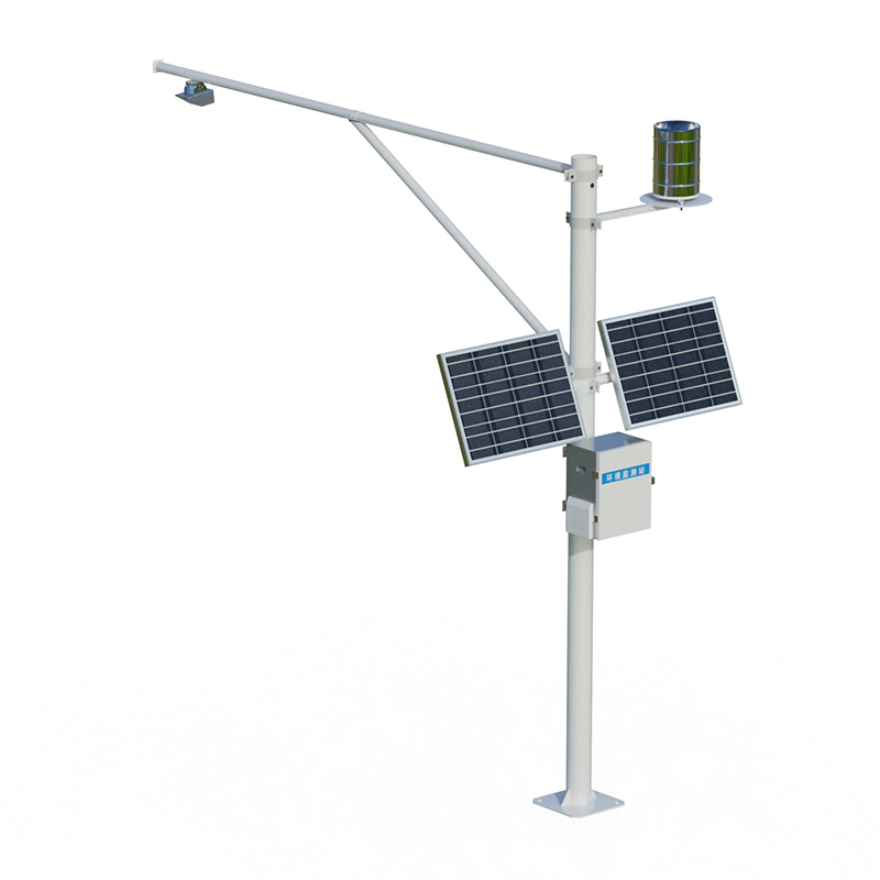
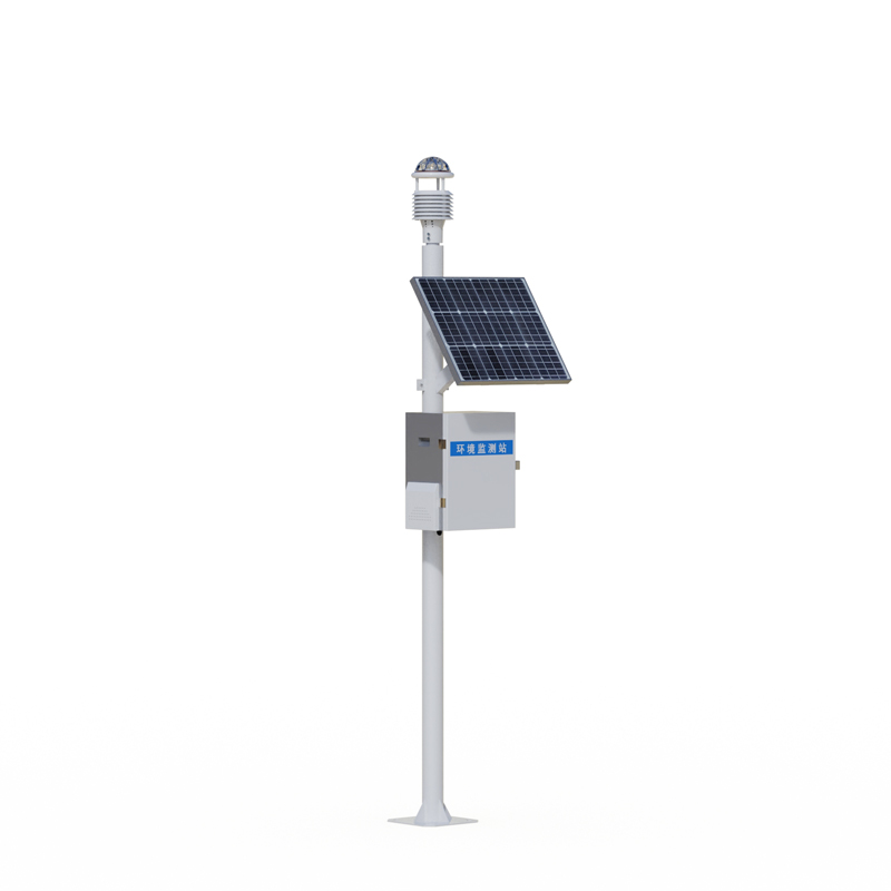
This fully automatic online hydrological monitoring system is based on microwave technology. It employs K-band planar radar technology to non-contactly measure water level, flow velocity, flow rate, and rainfall within channels. The system's built-in algorithm calculates cross-sectional flow and cumulative flow in real time. It supports multiple communication methods, including 4G/5G and BeiDou, and is widely used in rivers, irrigation canals, underground drainage networks, and flood control early warning systems, providing all-weather hydrological data acquisition and transmission services.
The hydrological monitoring system uses microwave radar technology as its core sensing method. K-band planar electromagnetic waves are emitted by radar flowmeters installed above channels or under bridges. Water level data is acquired using the frequency modulated continuous wave (FMCW) ranging principle, while the Doppler effect is used to measure surface velocity. The water level and velocity values are input into the built-in cross-sectional flow algorithm to calculate instantaneous cross-sectional flow and cumulative flow in real time. This system integrates a radar flow velocity sensor, a water level sensor, a solar power supply system, a telemetry terminal, and a data transmission module within a single integrated fixture. It features low power consumption, compact size, and easy maintenance. The measurement process is unaffected by temperature, sediment, river pollutants, and floating debris.
In the data acquisition and transmission phase, the hydrological monitoring system employs an automatic acquisition triggering method. Fixed sampling intervals can be set, allowing for 24/7 acquisition of hydrological parameters such as water level, flow rate, and rainfall. Water level measurement utilizes a planar array radar antenna with built-in measurement angle compensation. Installation requires no complex civil engineering; the sensor can be fixed to the riverbank, bridge, or sluice gate using a pole or cantilever mounting structure. The acquired data is processed by the telemetry terminal and uploaded to the backend management platform via wireless communication methods such as 4G/5G, GPRS, or LoRa. Local storage is also supported, automatically saving historical data in case of communication interruption and resuming transmission once the signal is restored. The platform provides real-time data display, trend curve plotting, and historical data query functions, automatically triggering alarms when water level or flow rate reaches preset thresholds.
From a deployment perspective, the water monitoring system can cover various environments, including rivers, irrigation canals, reservoirs, underground drainage networks, and mountain torrent channels. In urban flood control and drainage scenarios, the system works in conjunction with water level monitoring equipment in underground drainage networks to transmit real-time water level and flow data from key locations to the urban flood control command platform. When the monitored data reaches the warning threshold, tiered alarms and response plans are pushed out, forming a closed-loop management system from perception to decision-making. In irrigation area water measurement scenarios, the system interfaces with gate control systems and irrigation management platforms to achieve accurate measurement of channel flow and water consumption. It can allocate water distribution plans as needed, increasing the irrigation water utilization coefficient by more than 3 percentage points. In addition, the system's non-contact measurement method avoids the problems of silt abrasion, weed entanglement, and corrosion associated with traditional contact equipment. It can still output stable measurement data in water bodies with high sediment content, high weed density, and high corrosiveness, making it particularly suitable for long-term continuous monitoring scenarios in complex water environments such as mountain ditches, tailings dam drainage culverts, and open channels through which industrial wastewater flows.
With the booming development of ecotourism, scenic weather stations have become common devices in major tourist attractions and ecological parks (such as artificial wetlands, ecological parks, botanical gardens, etc.). It is dedicated to the all - day automatic online collection of air cleanliness i...
Compared with traditional embedded sensors, the Road Condition Monitor has distinct advantages in practical applications. It adopts non-intrusive installation, which does not require damaging the road surface structure. The installation process is simple and convenient, which can greatly reduce the...
Combustion is a common energy conversion method.During combustion, flue gas is emitted. Analyzing its composition—primarily components like oxygen, carbon monoxide (CO), and carbon dioxide (CO₂)—helps determine if combustion is complete and calculate combustion efficiency.The level of combustion...
The Anemometer for Drones FT-F1 is specially designed for low-altitude wind measurement by unmanned aerial vehicles (UAVs). With high precision, stability, and efficiency, it provides accurate data for meteorological research, agricultural and forestry monitoring, environmental surveying, and other...


 Skype
Skype
 whatsapp
 mail
mail