Tianqiong Sensor IOT Technology Co., Ltd
Sales Manager:Ms. Emily Wang
Cel,Whatsapp,Wechat:+86 15898932201
Email:info@fengtutec.com
Add:No. 155 Optoelectronic Industry Accelerator, Gaoxin District, Weifang, Shandong, China


Sales Manager:Ms. Emily Wang
Cel,Whatsapp,Wechat:+86 15898932201
Email:info@fengtutec.com
Add:No. 155 Optoelectronic Industry Accelerator, Gaoxin District, Weifang, Shandong, China
time:2025-09-26 09:29:29 source:Weather Station viewed:377 time
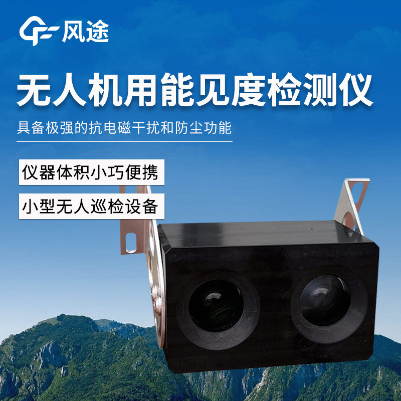
Traditional visibility monitoring mainly relies on ground-based fixed stations. While these stations can provide continuous data, they have limitations such as limited spatial coverage, high construction costs, and difficulty in mobility. Especially in complex terrain areas (such as mountainous regions, coastlines) or emergency sites (such as forest fires, chemical spills), the monitoring blind spots of fixed stations become decision-making bottlenecks. With the maturity of UAV technology, meteorological monitoring equipment has ushered in a mobile and three-dimensional revolution. UAV visibility meters, equipped with sensors, have achieved three-dimensional dynamic monitoring of atmospheric visibility, making up for the temporal and spatial limitations of traditional monitoring.
UAVs are highly flexible and can quickly reach areas difficult for humans to access, such as dense smoke areas of fires, flood-submerged zones, or radioactive contaminated areas, enabling emergency monitoring. Moreover, compared to establishing large fixed monitoring networks or using manned aircraft for monitoring, UAV systems have lower deployment costs and simpler maintenance. The lightweight design (as light as 110 grams) allows them to be adapted even to consumer-grade UAV platforms, greatly reducing the technical threshold.
The core technology of UAV visibility meters is based on the forward scattering method principle, which is an advanced method for inverting visibility by measuring the scattering intensity of suspended particles in the air to light. Specifically, the instrument emits an infrared LED light beam and detects the intensity of light scattered by particles at a specific angle (usually 35°). The more particles such as fog, haze, raindrops, and smoke in the air, the stronger the scattered light intensity and the correspondingly lower the visibility. By measuring the scattered light intensity and combining it with specialized algorithm models, the atmospheric visibility value can be accurately calculated.
Negative oxygen ions exert a significant impact on the physiological activities of the human body, and their effects are mainly realized through the nervous system and blood circulation process. For this reason, the concentration of negative oxygen ions in the air has become one of the key indicator...
With the accelerated pace of current urban construction and the frequent occurrence of abnormal climates, the pressure on drainage facilities has increased dramatically, and traditional waterlogging drainage methods are insufficient to withstand waterlogging caused by heavy rainfall. Against this ba...
Fentu Technology, a manufacturer of radar water level gauges, offers an 80GHz high-frequency radar gauge utilizing Frequency Modulated Continuous Wave (FMCW) technology. With a measurement range of 0.1 to 40 meters, an accuracy of ±5 mm, and a resolution of 1 mm, this device features a non-co...
Meteorology encompasses a wide range of elements, such as rain, ice, wind, frost, clouds, and temperature, among others. In the power system, "micro-meteorology" is different from what is described in meteorology. Power micro-meteorology refers to the meteorological conditions in a small s...


 Skype
Skype
 whatsapp
 mail
mail