Tianqiong Sensor IOT Technology Co., Ltd
Sales Manager:Ms. Emily Wang
Cel,Whatsapp,Wechat:+86 15898932201
Email:info@fengtutec.com
Add:No. 155 Optoelectronic Industry Accelerator, Gaoxin District, Weifang, Shandong, China


Sales Manager:Ms. Emily Wang
Cel,Whatsapp,Wechat:+86 15898932201
Email:info@fengtutec.com
Add:No. 155 Optoelectronic Industry Accelerator, Gaoxin District, Weifang, Shandong, China
time:2025-07-15 09:05:34 source:Weather Station viewed:431 time
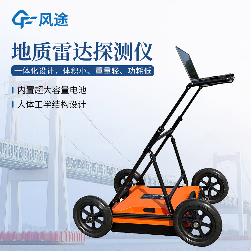
The working principle of Ground Penetrating Radar (GPR) is based on the propagation characteristics of electromagnetic waves. It emits high-frequency electromagnetic waves into the ground. When these waves propagate through underground media, once they encounter interfaces between different media—such as the boundary between soil and rock, or between cavities and dense soil—due to differences in the electromagnetic properties of the media, part of the electromagnetic waves will be reflected back. After the receiving antenna of the GPR captures these reflected waves, through data processing and analysis, it can generate images of underground structures. This is like performing a "CT scan" on the underground, clearly revealing the location, size, and distribution of potential geological hazard risks such as underground cavities, cracks, and weak layers. In mountain road detection, GPR can accurately identify cavities formed inside mountains due to rock fragmentation and groundwater erosion, thereby assessing the risk of landslides.
Traditional geological detection methods, such as drilling, not only damage the ground but also have low efficiency, making it difficult to comprehensively detect large areas. In contrast, GPR can quickly complete large-area scanning without damaging the ground. When investigating landslide hazards in large mountainous areas, using helicopters equipped with GPR enables rapid acquisition of large-scale underground geological information, efficiently identifying potential landslide-prone areas.
Using GPR for real-time monitoring of landslide bodies can promptly grasp their dynamics, buying valuable time for disaster prevention and mitigation. GPR can capture the dynamic changes of geological bodies over time through regular monitoring. In landslide-prone areas, affected by time and external factors, the rock and soil inside the mountains will gradually displace and deform. By comparing detection data from different periods, if GPR detects abnormal changes in the characteristics of reflected waves in certain areas inside the mountain—such as significant changes in the intensity or phase of the reflected waves—it can determine that the structure of the rock and soil in those areas may have changed. This, in turn, allows for analyzing whether the landslide risk has intensified and issuing timely warnings. In cities, factors such as fluctuations in groundwater levels and leakage of underground pipelines can cause changes in the compactness of subgrade soil. Continuous monitoring by GPR can promptly detect these changes, preventing ground subsidence.
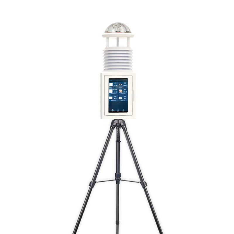
Portable Weather Station is a highly integrated, low-power, and rapidly deployable high-precision automatic meteorological observation device. It is suitable for various scenarios such as emergency short-term meteorological observation, mobile meteorological monitoring, and microclimate environment monitoring. It is primarily used for data acquisition in fields such as meteorology, agriculture and forestry, environmental protection, and emergency monitoring....
In the water conservancy and water services industry, water regime monitoring is a fundamental task. Especially during summer when natural disasters occur frequently, monitoring enables disaster prediction and provides data support for formulating flood prevention and relief plans. With the applicat...
The Portable Weather Station enhances monitoring convenience and efficiency with its lightweight, integrated design, meeting the demand for rapid and accurate acquisition of meteorological data across multiple fields.The core of achieving the lightweight and integrated design of such devices lies in...
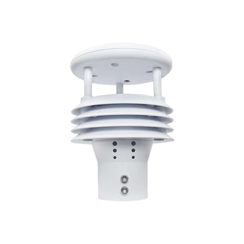
Mobile weather station is a highly integrated, low-power automatic weather observation device. It can monitor key meteorological elements such as wind speed, wind direction, temperature, humidity, atmospheric pressure, and optical rainfall in real time. It supports rapid installation and...


 Skype
Skype
 whatsapp
 mail
mail