Tianqiong Sensor IOT Technology Co., Ltd
Sales Manager:Ms. Emily Wang
Cel,Whatsapp,Wechat:+86 15898932201
Email:info@fengtutec.com
Add:No. 155 Optoelectronic Industry Accelerator, Gaoxin District, Weifang, Shandong, China


Sales Manager:Ms. Emily Wang
Cel,Whatsapp,Wechat:+86 15898932201
Email:info@fengtutec.com
Add:No. 155 Optoelectronic Industry Accelerator, Gaoxin District, Weifang, Shandong, China
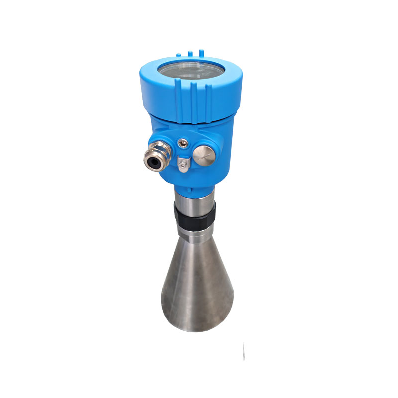
Model:YW-76
Brand:tianqiong
1. Product introduction of Radar Level Gauge
1. Radar Level Gauge product features
Radar Level Gauge can perform continuous and accurate water level measurement and can be used for temperature-resistant, pressure-resistant, and slightly corrosive liquids.76-81GHz frequency modulated continuous wave (FMCW) radar products, supporting four-wire and two-wire applications. With multiple models, the maximum range of the product can reach 120m and the blind spot can reach 8cm. Because it operates higher frequency and shorter wavelengths, it is especially suitable for solid applications. The working method of transmitting and receiving electromagnetic waves through lenses has unique advantages in high dust and harsh temperature environments (+200℃). The instrument provides flange or thread fixing, making installation convenient and simple.
2. Product advantages of Radar Level Gauge
Based on the self-developed CMOS millimeter-wave RF chip, it realizes a more compact RF architecture, higher signal-to-noise ratio, and smaller blind spots.
5GHz operating bandwidth enables the product to have higher measurement resolution and measurement accuracy.
The narrowest 3° antenna beam angle makes the interference in the installation environment have less impact on the instrument and more convenient to install. The wavelength is shorter and has better reflective properties on solid surfaces, so there is no need for special use of universal flanges for aiming.
Supports remote debugging and remote upgrades, reducing waiting time and improving work efficiency.
3. Radar Level Gauge Communication and Debugging
Instrument debugging can be performed through LCD on site, or the optional upper computer software can be used to debug on the PC side. The radar instrument and the PC communicate through the following methods:
USB to RS485 serial port cable (four-wire system);
USB to TTL serial port cable (two-wire system);
USB to Hart-modem (two-wire system) for communication.
Through Bluetooth debugging on your mobile phone, it makes on-site debugging safer and more convenient.
4G network, remote debugging is carried out through remote modules.
2. Radar Level Gauge Technical Specifications
Measuring medium: water
Measuring range: 0.05m~35M (regular, maximum measurement of 120m)
Process connection: G1½A/1½NPT thread/bracket
Process temperature: -40~80℃
Process pressure: -0.1~0.3MPa
Antenna size: 42mm lens antenna + speaker ∅146mm
Antenna material: PTFE+304 speaker
Accuracy: ±1mm
Protection level: IP67
Center frequency: 76GHz~81GHz
Emission angle: 6°
Power supply: two-wire/DC24V
Four-wire/DC24V
Four-wire system/AC220V
Housing: Aluminum (with display)
Signal output: RS485 Modbus
Display: with display
Power consumption: less than 0.03W
Response speed: millisecond level
Other functions: can modify the speed of data transmission
The crop growth condition is an important term in the agricultural field, referring to the growth and development status of crops at various stages from sowing to maturity. It includes comprehensive information such as plant morphology, population structure, and physiological indicators, and is cruc...
The 4G high-precision handheld 6-element weather station is a portable and easy-to-operate mobile meteorological observation instrument. It can monitor six meteorological elements, supports 4G data upload, and is suitable for various mobile meteorological observation scenarios....
With the acceleration of urbanization and industrialization, regional and complex air pollution problems have become increasingly prominent. Traditional ambient air quality monitoring networks typically consist of a limited number of well-equipped national or provincial control stations. While these...
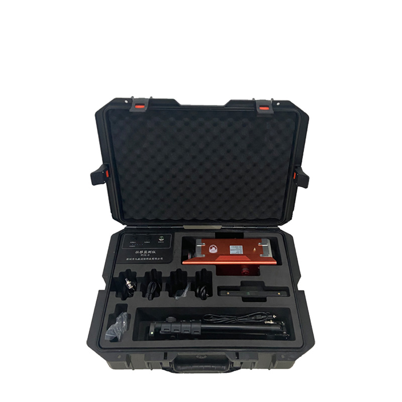
The bird DNA Test device, priced at 68,000 yuan, can simultaneously identify the sex of pigeons and perform genotyping of genes affecting flight ability, such as homing ability (DRD4), endurance (LDHA), and navigation ability (CRY1). The device supports processing multiple samples simultaneous...


 Get a Free Quote
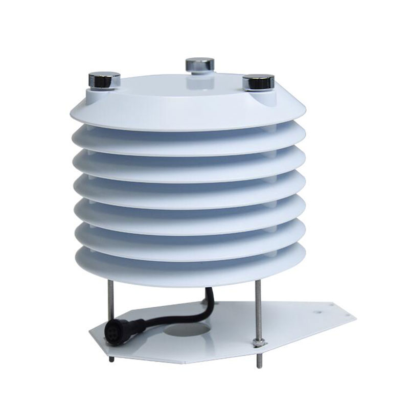
 Skype
Skype
 whatsapp
 mail
mail